Sunday Hikes
 Silver City is at 6,000 feet, yet temperatures can stay warm in September. Stay hydrated; higher altitude and temperature increase the risk of dehydration. Bring water for all excursions. Please bring a reusable water bottle: the conference center has a filling station. No single-use disposable water bottles will be provided. Hats are recommended. For hikes, participants should wear sturdy closed-toe hiking shoes or boots, consider bringing hiking poles and a raincoat, and snacks. No pets. Most field trips require car pooling; many locations have limited parking or require 4WD. Please take others, and passengers, please contribute gas money.

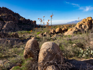
Off Highway 180 East, about 4 miles from Silver City
F 25 Dragonfly Trail Petroglyph Hike. Easy/moderate, about 3 ½ miles, little elevation gain. Leaders: Marty Eberhardt and Ann Hedlund. This hike takes participants through piñon-juniper grassland and a riparian area with lovely petroglyphs, including dragonflies, near the water. The hike is off Highway 180 and is convenient to those heading home south or through the Black Range (Highway 152). Limit: 12
 Off Interstate 10 and Highway 80, Southwest of Silver City, approximately an hour’s drive (one-way)
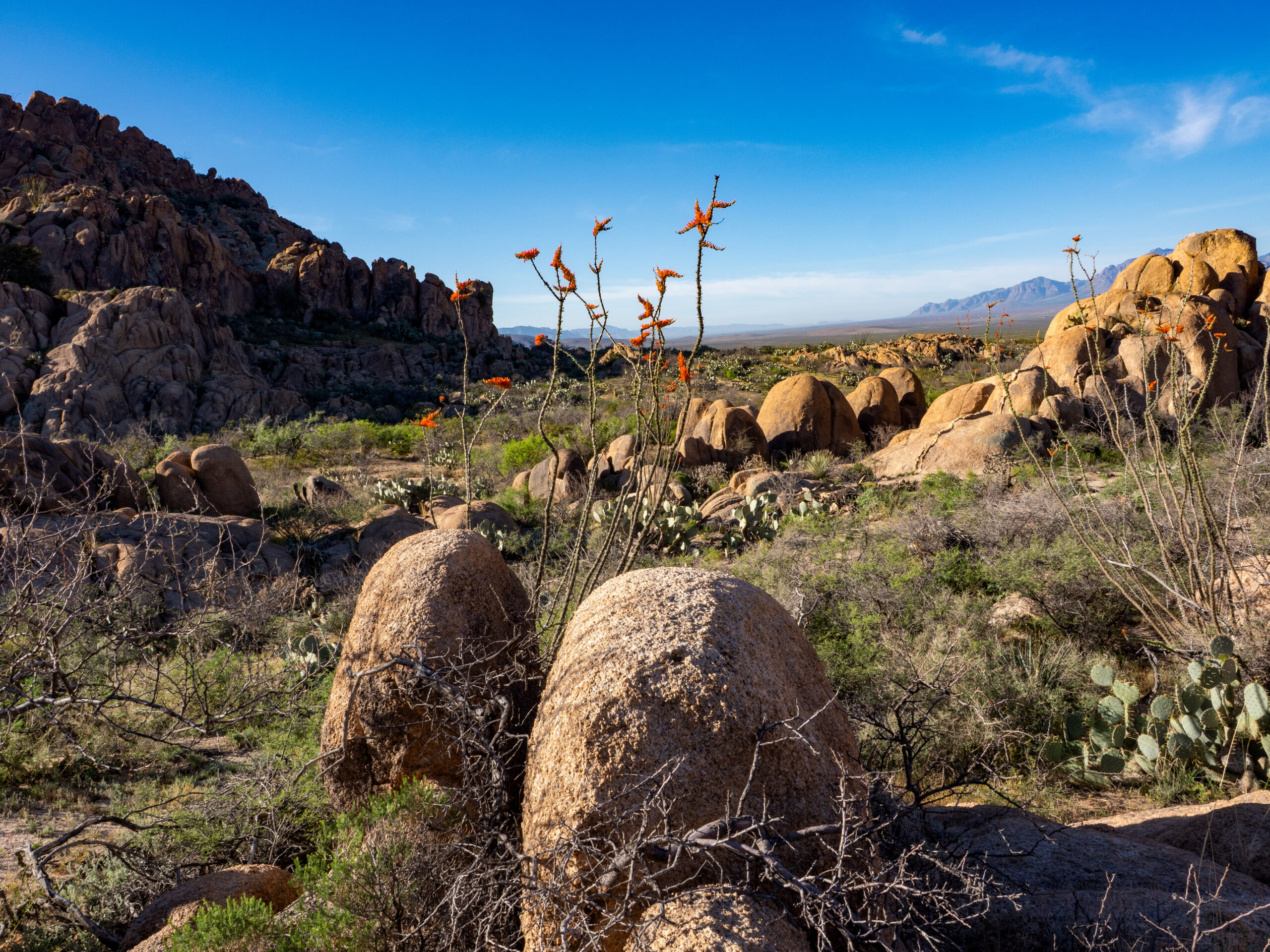
F 26 Exploring Granite Gap. Easy/moderate, about 3 ½ miles, little elevation gain. Leader: Steve Mudge. This hike is an opportunity to explore the Granite Gap area of the Peloncillo Mountains on the border of New Mexico and Arizona. Participants will learn about how some of the plants in the area can be used in home gardens.
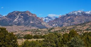
Off Highway 152, Northeast of Silver City
F 27 Black Range Crest Trail. Moderate/difficult, 4 miles. Leaders: Wendy and Don Graves. This hike will offer participants stunning views of the Black Range and some amazing native plants. The trail winds for five and a half miles to the top of Hillsboro Peak, where there is a fire tower and Forest Service cabin. Although the planned hike is only four miles round-trip, some participants may choose to continue to Hillsboro Peak, an 11-mile round-trip. Limit: 12
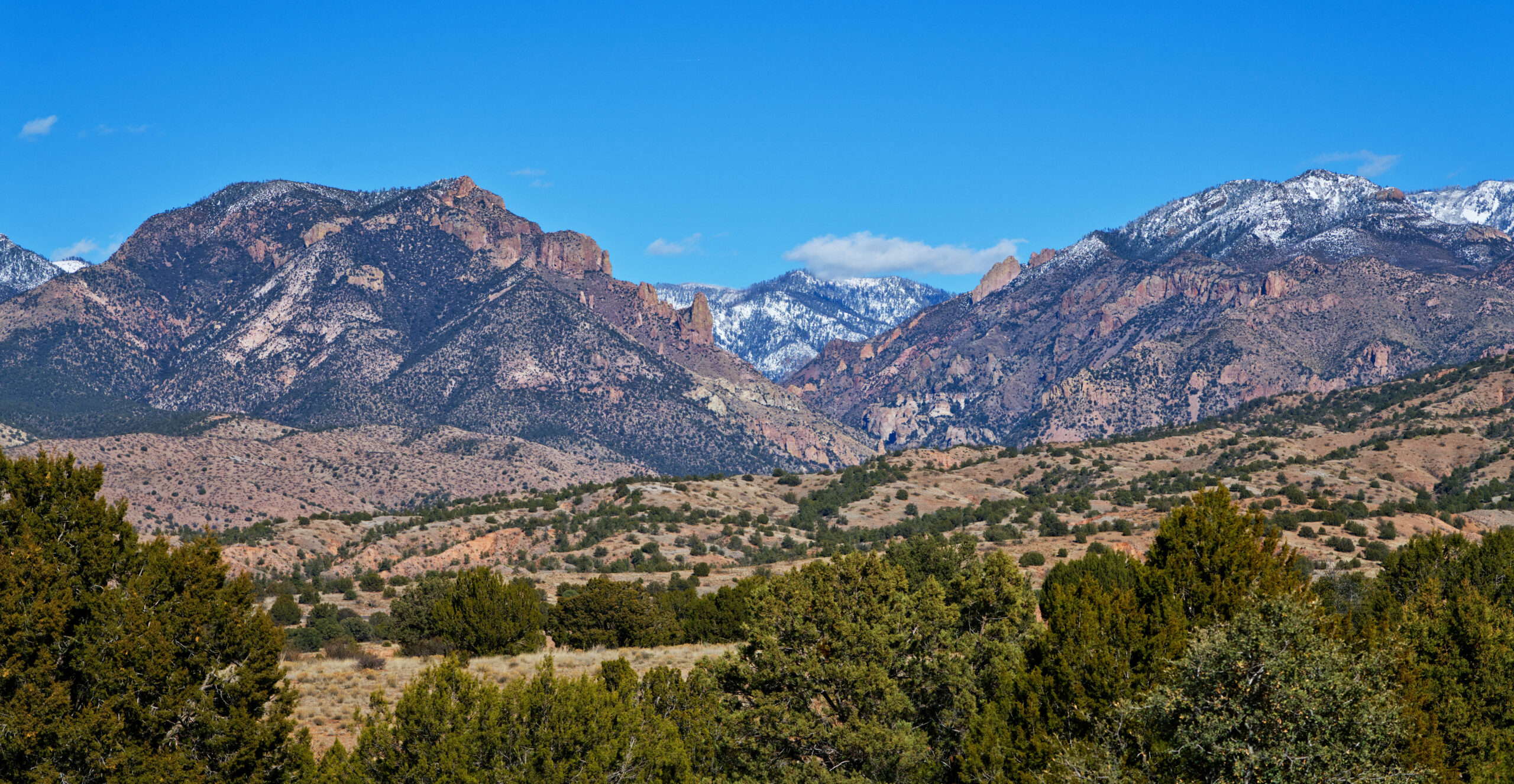
 Off Highway 15, North of Silver City, about a three-hour round-trip drive

F 28 Gila Cliff Dwellings Exploration. Moderate, about 1 mile, 180’ elevation gain, uneven surfaces with steps. Leader: Jonah Snead. Join a ranger on this hike to explore the Gila Cliff Dwellings, including the canyon’s riparian corridor, cliffside habitats, and the cultural landscape of the Gila. Throughout the walk, participants will make frequent stops to discuss native plant communities, wildlife relationships, geology, and active land stewardship. Food, flavored drinks, gum, tobacco, and pets are prohibited on the trail. Limit: 15
F 29 Plant Biogeography of the Gila River Headwaters. Moderate, with river crossings and some slippery rocks; 2 to 4 miles, depending on the group; little to no elevation gain. Leader: Patrice Mutchnick. This hike will follow the Gila River and showcase the river’s resilience through fires and floods. Depending on water levels, the hike will be along either the main stem of the Gila River or the Middle Fork of the Gila River- both trailheads are about a 75-minute drive north of Silver City. Both trails will involve river crossings with some slippery rocks. Limit: 12
 Off Highway 180, Northwest of Silver City, about 3 ½ hours roundtrip
F 30 Visit The Mogollons. Moderate/ difficult, about 5 miles, elevation gain 500’. Leader: John Gorey. This hike begins at the Willow Creek trailhead and continues into the wilderness, where participants may see many wildflower species, including Graham’s Thistle, Mogollon Death Camas, and various butterflies and bees. A rain jacket may be necessary depending on weather conditions.